SUDAN’S BREADBASKET TURNED TO DUST: SATELLITE IMAGERY REVEALS WAR’S SCORCHED-EARTH TOLL
By the Prospera Intelligence & Monitoring Unit
Dateline: May 4, 2026
AL JAZEERA EXCLUSIVE ANALYSIS – For three years, the world has heard of atrocities and famine in Sudan. Now, satellite imagery has laid bare the invisible devastation: the systematic annihilation of the country’s agricultural heartland, followed by a fragile, tentative recovery that hangs by a thread.
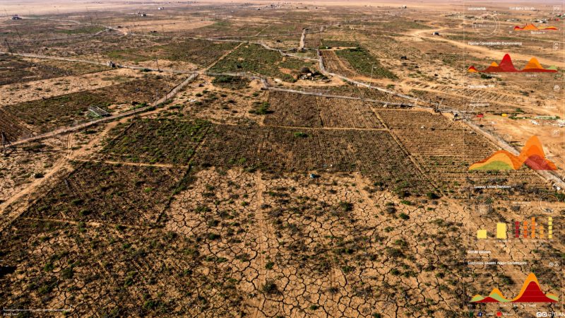
A digital investigation by Al Jazeera, using European Space Agency’s Sentinel-2 satellites and the Normalised Difference Vegetation Index (NDVI), has documented how the war between the Rapid Support Forces (RSF) and the Sudanese Armed Forces (SAF) turned the fertile central states of Gezira, Sennar, and Khartoum from vibrant green geometric farming grids into barren, dusty brown landscapes.
The story is not one of climate or drought. It is a man-made catastrophe. And critically, the imagery shows that after the SAF recaptured key territories in late 2024 and early 2025, the green rectangles have begun to return – cautiously, patchily, but measurably.
THE COLLAPSE: WHEN THE RSF TOOK THE FARMLAND
The fertile plains of central Sudan, long known as the country’s “breadbasket,” began to die in December 2023. That month, the RSF captured Wad Madani, the capital of Gezira state – home to the legendary Gezira Scheme, an irrigation project spanning 924,000 hectares (2.28 million acres) with over 8,000 kilometres of canals. Historically, this single scheme produced half of Sudan’s wheat.
Under RSF control throughout 2024, the agricultural system did not simply decline – it disintegrated.
Independent assessments, including a study by the United Nations Food and Agriculture Organization (FAO), confirmed that wheat production in Gezira plummeted by 58 percent during the 2023-2024 season. But the satellite data reveals how this happened on the ground.
The NDVI measures the density and health of green vegetation. In an engineered, irrigated scheme like Gezira, active farming produces unmistakable geometric rectangular grids – the signature of human coordination: pump stations operating, water gates opened on strict schedules, fertiliser applied. When the system collapses, those precise patterns vanish, replaced by chaotic, irregular patches of green and brown that indicate abandoned land overtaken by wild grass.
The Famine Early Warning Systems Network (FEWS NET) confirmed this pattern: under RSF control, the distinctive agricultural geometry disappeared.
But the destruction was not passive. RSF fighters systematically looted markets, police stations, and the agricultural bank. They diverted irrigation channels, intentionally flooding agricultural lands. In a desperate act of defence, local farmers themselves flooded their own canals – sacrificing their crops to turn fields into mud traps to halt the RSF’s heavily armed pickup trucks.
The al-Haiwawa canal, a critical artery serving 2,360 farmers across 48 villages, was among the most severely damaged, according to the FAO.
The economic impact cascaded immediately. Hussein Saad, a former farmer and member of the Gezira and Al-Managil Farmers Alliance, told Radio Dabanga that a 50kg bag of fertiliser skyrocketed from 20,000 Sudanese pounds (33)to120,000pounds(200). Tractor rental prices tripled. Armed fighters looted the national seed bank and drained World Food Programme warehouses in Wad Madani that had held enough food to sustain 1.5 million people for a month.
An RSF-imposed telecommunications blackout in early 2024 paralysed all financial transfers. Consequently, 200 out of 300 local soup kitchens that were keeping displaced families alive were forced to close.
Similar devastation was recorded in the Rahad and Suki Schemes in Sennar and Gedaref states – covering 126,000 hectares and 37,800 hectares respectively – where crop health drastically deteriorated under RSF control throughout 2024.
THE FRAGILE RECOVERY: AFTER THE ARMY RETURNS
The satellite data exposes a direct, almost mechanical correlation: military control determines food production.
In November 2024, the SAF recaptured Singa in Sennar state. In January 2025, they took back Wad Madani. By March 2025, the army controlled most of both Gezira and Sennar states.
Then, NDVI data from December 2025 showed a notable improvement. The geometric green grids – the signature of active farming – began to reappear across the Gezira, Rahad, and Suki Schemes. Farmers, cautiously, resumed planting.
This aligns with an Integrated Food Security Phase Classification (IPC) report. At the peak of the crisis, 25.6 million people – half the country’s population – faced acute food insecurity, including 755,000 in catastrophic famine conditions (Phase 5). By late 2025, the IPC noted that 3.4 million people were no longer in crisis levels, attributing the improvement explicitly to the gradual stabilisation in Gezira, Sennar, and Khartoum following the RSF withdrawal.
However, the recovery is far from complete. Fertiliser prices remain six times higher than before the war. The national seed bank is empty. And the recovery remains conditional on the SAF holding the territory.
THE CONTROL GROUP: WHY IT WAS NOT CLIMATE
To definitively rule out climate anomalies or regional drought, the investigators used Khartoum state as a “control group”. Khartoum shares the same climate zone and rainfall patterns as Gezira, lying just 150 kilometres to the north. But it experienced a different military timeline.
The SAF only declared full control of Khartoum in May 2025 – just six months before the December 2025 satellite analysis.
Imagery of four major agricultural projects around the capital – North Bahri, East Nile, Sundus, and Kutranj – showed no significant recovery in 2025. The fields lacked the precision geometry of active farming. They remained barren and overgrown with wild grass.
This contrast proves a crucial lesson: security alone is not enough. Farmers need a full, uninterrupted season of stability to repair canals, source seeds, and harvest crops. Khartoum’s fields will likely not recover until the 2026-2027 season at the earliest.
INDUSTRIAL RUIN: BEYOND THE FIELDS
The war’s scars extend far beyond agriculture. High-resolution satellite imagery from Planet Labs reveals widespread destruction of industrial infrastructure.
According to statements made by Sudan’s Minister of Industry, Mahasin Ali Yagoub, to the Al-Sudani newspaper, 126 large industrial facilities and 3,131 small factories in Gezira state alone were severely damaged.
While limited reconstruction of factories was observed in Wad Madani by early 2026, Khartoum’s industrial zones remain largely in ruins. Nearly 3,200 facilities in the capital have been destroyed, with no tangible signs of recovery.
The image is stark: a breadbasket scorched, factories gutted, and a population of 25 million who depended on these lands now facing a recovery that will take years – if the ceasefire holds.
WHAT THIS MEANS FOR PROSPERA’S DESK
For editors and analysts, this story offers high-evidence, low-speculation reporting. The satellite data, control group methodology, and multi-source humanitarian reports converge on a clear narrative:
Under RSF control (2024): Systematic agricultural and industrial scorched earth.
Under SAF control (late 2024–2025): Fragile, partial regrowth – still far from pre-war levels, with industrial recovery near zero.
Key storytelling assets:
- Visual contrast: Side-by-side imagery of geometric green grids (pre-war) versus barren dust (under RSF) versus patchy green (recovery) is powerful and verifiable.
- Avoid simplistic “recovery” headlines: The return of green grids is real but conditional. One RSF counter-offensive would destroy them again.
- Human detail: The fertiliser price jump (sixfold), the flooded canals as defence, the 200 closed soup kitchens – these ground the satellite data in lived experience.
Risks to monitor:
- A renewed RSF advance into Gezira or Sennar would likely produce even more systematic destruction as revenge scorched-earth.
- Even under SAF control, sixfold fertiliser prices mean only better-off farmers can resume. Most smallholders remain excluded.
- If the RSF reimposes telecommunications blackouts, humanitarian access will collapse again.
SOURCES AND VERIFICATION
This report draws exclusively from the Al Jazeera digital investigation published May 4, 2026. Primary sources cited include:
- European Space Agency (Sentinel-2 satellite imagery)
- Planet Labs (high-resolution industrial damage imagery)
- UN Food and Agriculture Organization (FAO)
- EU Agency for Asylum
- Famine Early Warning Systems Network (FEWS NET)
- Integrated Food Security Phase Classification (IPC)
- Sudan’s Minister of Industry, Mahasin Ali Yagoub
- Radio Dabanga (local farmer alliance, Gezira)
The analysis uses NDVI data with the critical caveat that it cannot differentiate crops from wild grass alone. However, the “geometric grid” signature of active, coordinated irrigation farming is a reliable proxy for human-managed agriculture, as validated by FEWS NET.